 |
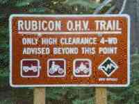
Welcome to Rubicon-USA
or simply the 'Con
Ru-bi-con (rü-bi-kän) noun [Latin: Rubicon, Rubico]
- A river in northern Italy forming part of the boundary between Italy and Cisalpine Gaul. Crossed by Julius Caesar in 49 B.C. while marching against Pompey, his crossing was considered an act of war by the Senate... and committed Julius Caesar to 'conquer or perish'.
- A boundary or limiting line; esp: one that when crossed commits a person irrevocably.
- To take a decisive, irrevocable step.
Links to other information about the trail:
- Trip Reports
- The Rubicon Trail; Northern California
- The TLCA's Virtual Wheeling: Rubicon page
- Deer Valley Press "4 Wheeler's Guide to the Rubicon Trail" is an excellent guide book.
- For the ultimate Rubicon site, check out the Pirates of the Rubicon.
- The automated Van Vleck snow station is close to trail and has up-to-date snow pack information.
![]()
About the trail:
The Rubicon crosses the Sierra Nevada mountains, starting at Georgetown (on CA Hwy. 49) and ending up near Lake Tahoe at Rubicon Springs. Elevations run from a 6300-7100 feet. The section of road from Georgetown to Wentworth Springs is apparently a fairly well maintained road and the real action begins near Loon Lake. As such, most people begin the run from this mid-point, accessible off US Hwy. 50 as follows:
After Pollock Pines, head towards Tahoe on US-50. The Ice House road turnoff is about 10 miles after Pollock Pines on the left, just after crossing the Feather River Bridge. After the bridge look for a left-hand turn lane to Ice House road. Continue up this 2 lane road for about 15-18 miles, passing Ice House Resort (which is red) and will be on your right. Continuing on you'll pass Rob's Resort on your right (keep going straight). As you climb this hill look for a sign saying Loon Lake, the turnoff will be on your right. After making the right follow this 2 lane road up a step hill with a valley to your right and across the first dam part of the lake continue on until you hit dirt and proceed across the back dam. This road will part at the opposite side of the dam, stay to the left and follow this to the bottom of the dam.
After reaching the slabs below the 2nd dam, finding the trail is no easy task. The trail drops down hill and to the right. At the base of the slabs, you'll enter the trees and soon encounter Pinch Rock. Once here, you continue on over some more slabs, up Walker Hill and the Little Sluice before reaching Spider Lake, which is a good spot to camp. The next stretch features the Old and Big Sluices before reaching Rubicon Springs, another good camping spot. The final stretch of trail includes Cadillac Hill, the great view at the Observation Point, and the l-o-n-g drive out to Tahoma and the end of the trail.
![]()
Trip Reports:
- July 27-29, 1998
- Scott Wilson's Rubicon Trip Report - August 12-13, 1999
- Wentworth Springs - April 15th, 2000
July 27-29, 1998:
A total of 11 Toyota 4x4s (4Runners, pickups, and an FJ-40), two Samurais and a Jeep Wrangler met at the slabs Monday morning. I had arrived late Sunday night with my passenger and camera man (Ron Mendelbaum, visiting from Tel Aviv, Israel) after a 13 hour drive from the San Bernardino Mountains where we participated in the 6th Annual 4Runner Jamboree the weekend before.
Ron and I arrived about 11:30 Sunday night and missed the main group in the darkness. Following the directions, we crossed the 2nd bridge and threw down some sleeping bags on the granite in the darkness. About 8 the next morning, we saw a bunch of Toyotas gathering on the dam and pretty soon they were driving down towards us. We jumped in behind the last of the group.

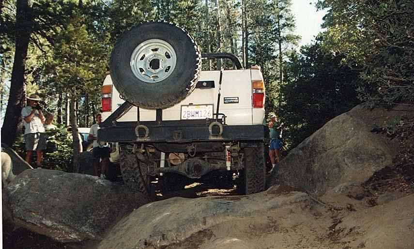
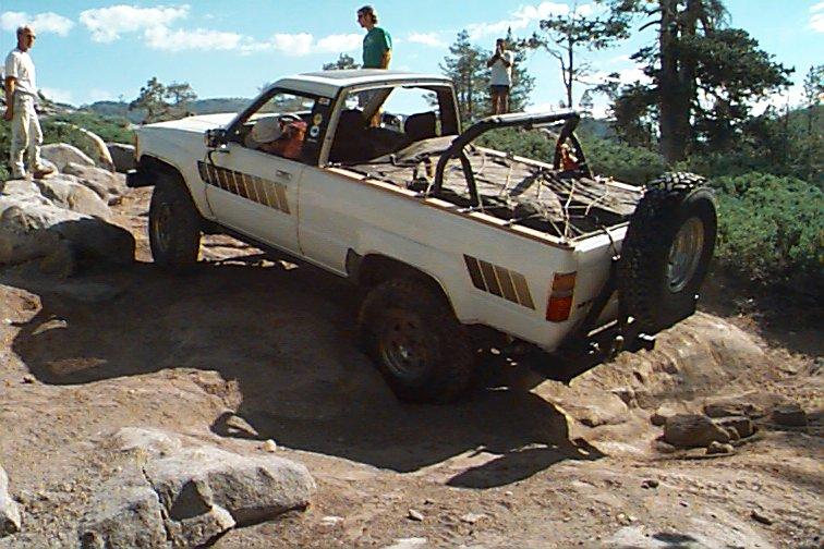
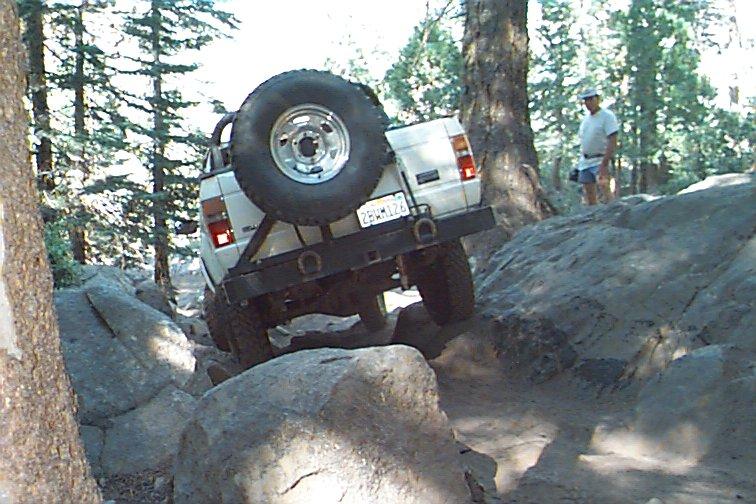
I was taking up the rear and everyone had driven through the first obstacle, Pinch Rock. Not knowing this was a tough spot, I just drove through, making a nice pivot turn on my Rock Sliderz. You can see the paint on the rock near my left rear tire. I caught up with the group at the stair steps on the slabs.
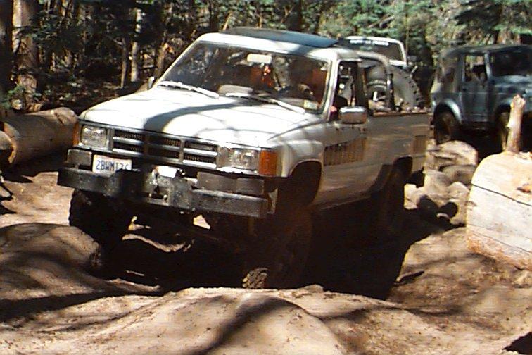
After climbing up and over the slabs, we got to Walker Hill without incident. I ran most of the whole trail in low-low range (Marlin) and used 2nd-5th gear most of the time, dropping into 1st for those fun spots. I was behind ~ Trail Dogg ~ (aka Sea Bass!) when he broke a motor mount, near the top of Walker Hill, which caused his throttle to jam wide open. I think he made the fastest climb on record up Walker Hill. After a bit of trail-side repairs we were moving again.
At the top of Walker Hill, is a fun little obstacle called the Soup Bowl. It consists of several granite steps making up a right hand turn. After watching two nicely built 4Runner's try and fail to climb the Soup Bowl, Bill in his Sammy popped right up with no problem. Soup Bowl is an obstacle favoring short wheelbase vehicles. I opted *not* to try it.
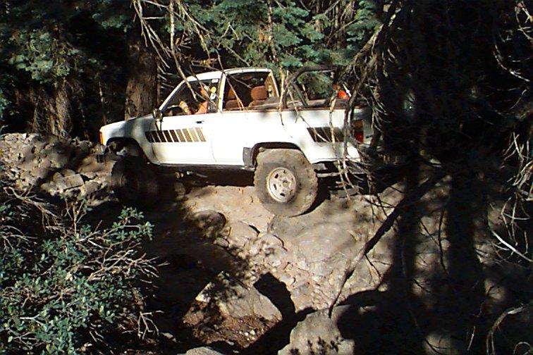
At the Little Sluice, a group of us took the Four Wheeler bypass, skillfully guided by Darrell Creeks. This bypass is to the left side of the Sluice and goes up parallel to it and drops steeply back into the sluice. The other bypass on this side goes up higher on the slabs, squeezes between two trees before dropping down the slabs on behind the sluice. The third bypass, taken by Chris Geiger and Sea Bass involves driving up the sluice then making a sharp right hand turn to climb out onto the slabs. Recent rains had washed loose sand and dirt onto the smooth granite forcing both vehicles to need assistance getting out. The remainder of the group drove through the Little Sluice with no major incidents.
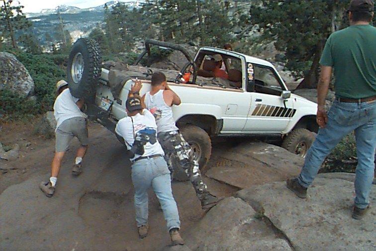
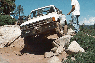
After climbing up over the slabs beyond the Little Sluice, I got hung up on my transfer case cross member dropping off this ledge. Here, Luke, Bill and Ron give me a little nudge.
We finally made it to Spider Lake, only to find a group of backpackers and the Jeep-List group had snuck by us as we played in the Little Sluice (Tip: Consider sending someone ahead to secure a campsite). We had to circle the lake to the back camp site. At the last little climb to the campsite, Sea Bass caught his rear drive shaft on a rock and nearly destroyed it. After sunset, we were joined by Troy (rock lights a-blazin') and Keith, who served as out Pirate guides for the rest of the trip.
The next morning, with a spare motor mount, u-joint, some spare angle iron from Darrell's flat bed skillfully welded to the straightened drive shaft, Sea Bass' truck was once again moving under its own power and he drove it back out to Loon Lake with another pickup.
Getting out of Spider Lake is as tough as getting into it. Darrell led one group out the back way, to avoid the steep ledges.
Our group continued on eastward in two main groups towards the Old Sluice. Along the way, Brian bent a drag link which was repaired by welding some pare tools as reinforcing to it (wonder how good that Craftsman warrantee is?). Not wanting to drop into the same hole as Brian; Luke and I took this *easier* route with only a 4' drop off.
Half our group went up the Old Sluice and the rest of us did the middle bypass along the slabs. Much of the trail was 20°+ off-camber so I was glad I had the top off my 4Runner. The two groups met up at the dam crossing at Buck Island Lake.
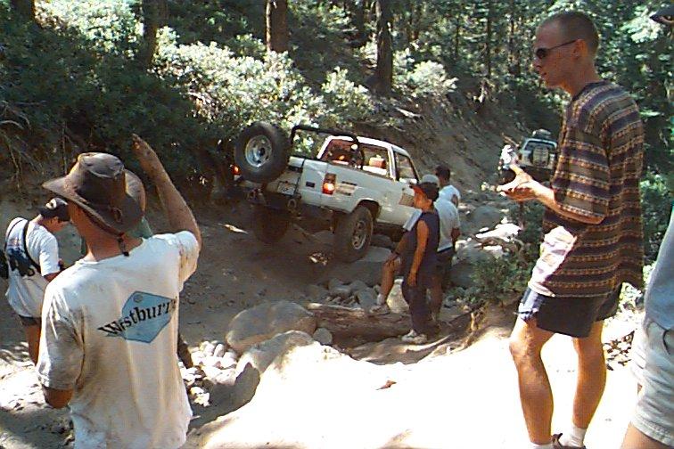
The drop into the Big Sluice caused a good backup with our group and the JeepL group. Darryl broke his cross-over steering tie rod at the big rock, it was replaced with a spare. Looking much worse than it was, the drop off the big rock was none the less exhilarating. Darrell did a superb job spotting everyone down the big rock. Troy made it look like child's play with his 3/4 ton Toyota, wide axles and 38.5" Swampers, although he actually had to lock both front hubs to make it! With the front diff welded, he had little steering control, so the truck went where it wanted. I crawled down in Marlin low range, but didn't yet have the knack of barking properly. So, once my front wheel dropped off the rock, I did a bit of a free fall until another wheel took the load. I have since learned that brakes really help to keep the drive line tightened up in downhill situations and really help the control factor.
After wandering through the tight trees, we found a campsite at Rubicon Springs. We listened while 4 rigs made the climb up Cadillac Hill in the approaching darkness. They ran into a Jeep that was blocking the trail w/ electrical problems. The driver had abandoned it to get parts, so they needed to winch it out of the way to get by.
We left early the next morning to tackle Cadillac Hill. I got hung up briefly on one ledge with a front tire in the air. By applying the brakes, I got the front TrueTrac to lock up and it pulled me up with ease. Weird feeling the truck begin to move forward as you apply the brakes. We got to the top of Cadillac Hill by about 11 AM where Brian, Todd, Chris, and Bill drove up on Troy's Swampers for a photo-op. Brian's solid axle 4Runner was the only rig with all tires down, his front Alcan/rear Mazda springs showing excellent articulation. Another 2-1/2 hours brought us out to the trail head and pavement.
The Rubicon trail is excellent. The best single word description I've heard for it is "relentless". From the time you begin driving at 9AM until you reach camp at 5PM, you are constantly at the limit. Was really impressed with the Pirates of the Rubicon that went with us and that we met on the trail, a great bunch of folks. I plan on returning next year! Most of the photos on this page are courtesy of Chris Geiger and Ron Mendelbaum.
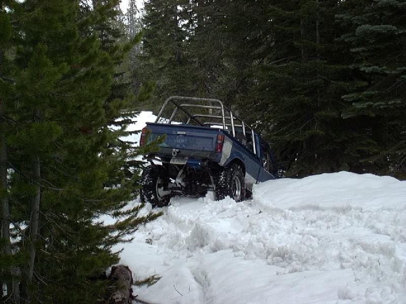
Wentworth Springs - 15.APR.2000:
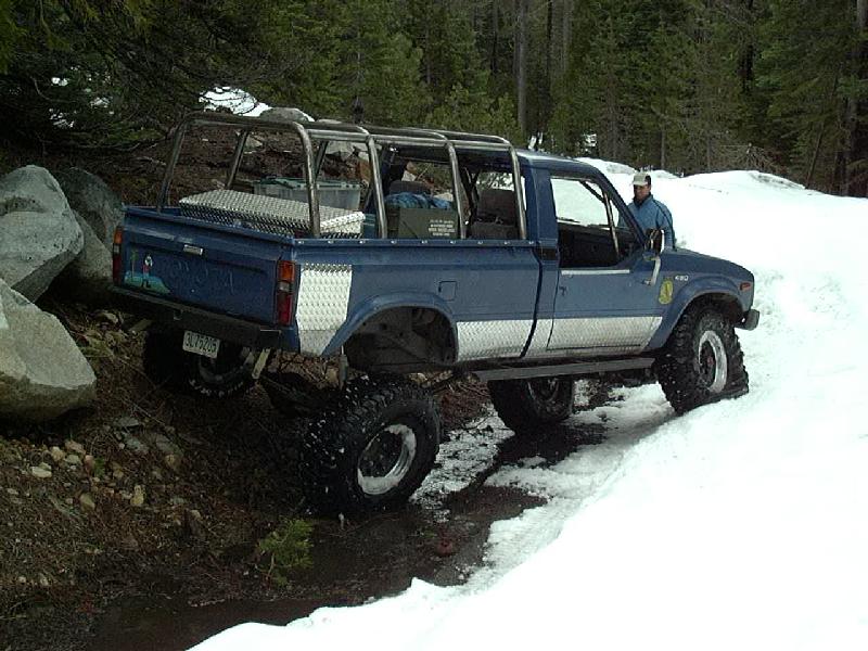
It had been a slow winter for wheeling with all the work I had been doing on my truck. When Eric Woodworth suggested a day trip up on the Rubicon, I decided to go. We met at his house off of US-50, loaded his '83 bobbed long bed on the trailer and headed up to the Wentworth Springs turnoff. No sooner did we hit the first snow on the road, than we had to help pull a pickup that was stuck out for the snow. The three passengers had spent the night there and were working and freeing the truck. A quick tug and Eric had them out of our way. Once past this truck, we found ourselves breaking trail over recently fallen snow.
Here's Eric checking out the flex on his rear Chevy springs. Looks like they twist up pretty darn good!
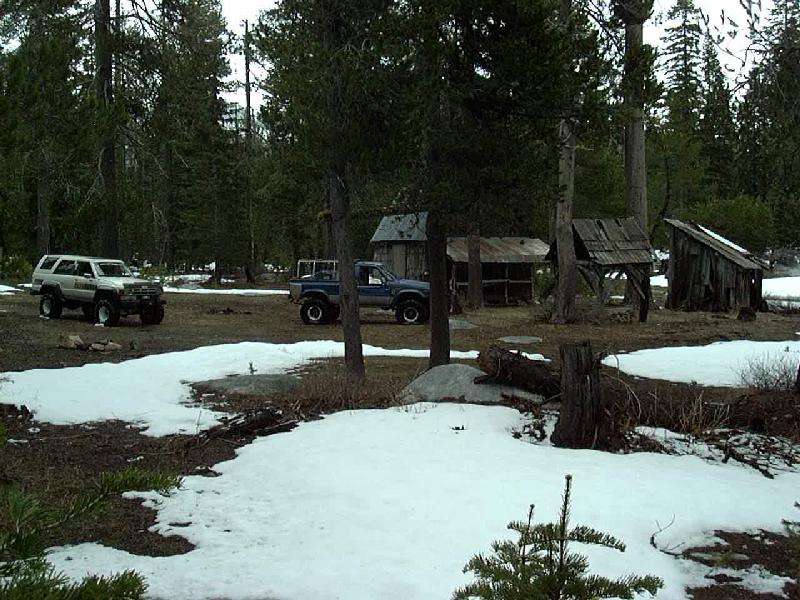
We stopped for a break at a nice camp about an hour into the trail.
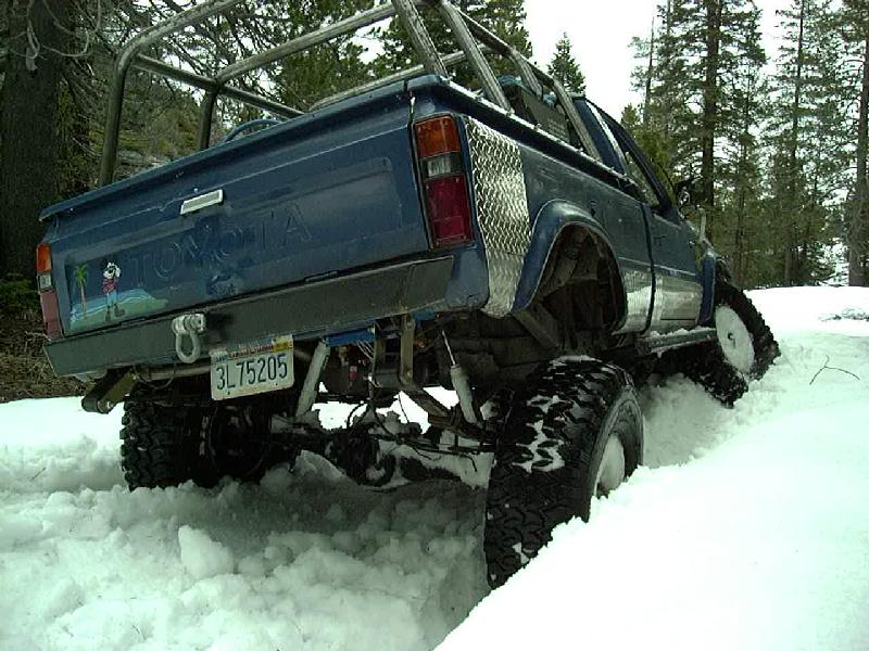
The higher we went, the deeper the snow got. We also noticed a slight leak in Eric's driver's side front tire, a shot of air brought it back up. As the leak seemed very slow, we decided not to fix it and pressed on. Here, Eric is trying to climb one of the off-camber snow banks, the front end keeps sliding off the diagonal slope.
Did I mention the snow was getting deep!
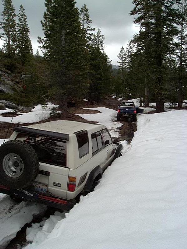
Actually, we were plowing a trail along this deep snow bank on the passenger side and some big rocks on the driver's side, essentially breaking through the thin crust of snow covering the stream of melt water. All the other snow runs I've been on have been fairly mellow. Usually, its just a matter of staying on top of the snow. This run was different, the winter winds and spring melt had sculpted the snow on this normally 2WD road into a frame-twisting, off-camber maze. The sides of the road had melt water undermining the snowbanks, leaving a 3-6' high ridge in the middle. You had the choice of trying to straddle this ridge (if you could get up on it) or running one side in the ditch with the other side up high on the snow bank, often at 30° side tilt. Just to make things interesting, you'd run into diagonal cuts in the bank, that you'd either have to climb or drop off of. There was also a lot of fairly deep water to ford, at one place, my 33's dipped beneath the surface, Eric's 35's just had the tread blocks above the surface. We had to cut and pull a few fallen trees out of the way, plus drive over many others.
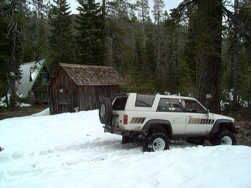
We stopped for lunch at Wentworth Springs. Seems like a very nice place, the Forest Service campground was about 1/2 mile farther up the road. Took us a while to get there, though. We had to stop and cut a few fallen trees out of the road.
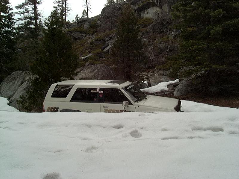
Here we finally reach the campground and Eric dropped off a tall drift, slamming his passenger front tire into log at the bottom, popping the tire off the rim. After getting the truck level, we pulled the tire to see if it could be reseated, but a 3" long gash in the sidewall suggested the spare tire would be a better idea. With the other front tire leaking air and time running short (it had taken us almost 6 hours to get here, approx 5 miles from the main road, and it was getting late, about 3 PM) we decided to get turned around and start working our way back to the trail head.
We ran into 5 other trucks coming in as we headed out, just after turning around. There were two pretty tough spots on the way out, made worse by the incoming traffic. The first was at a tough spot on the way in. There was no way to follow the incoming tracks, so we had to drive in the ditch to the left, then back in to point straight up the bank. The second obstacle was near the end of the trail, one of the first diagonal cut banks we dropped off of. Eric was able to pop up on top with his 35" tires, but I found my transfer case crossmember was hanging up every time I tried to crest the bank. I finally was able to winch off a nearby tree about 3 feet forward, leaving my driver's front one one edge of the crest and the passenger rear just off the opposite side. A bit of maneuvering got me straddling the ridge and we were off to the end of the trail.
I'd definitely like to run this section of the Rubicon trail again. We didn't get to the infamous "Rock Pile", don't know if it would have been passable with the snow conditions. Weather forecasts were predicting a few feet of new snow in the week following this trip. We had sporadic flurries of sleet and snow during the day and some pretty heavy rain as we headed out of the mountains.
![]()
 ===>>
===>> 
![]()