![]()
One Dusy of a Trip
Sept. 6-8, 2001
![]()
The Gettin' Off 4WD club finally got enough folks together to run the Dusy/Ershim trail. We had been trying to set up a trip for about 2 years since last running the trail in 1999.
Itinerary:
-
9/5: Arrive in the area Friday evening
- Camping Voyager Rock (at least I was there), park tow rigs at Shaver Lake.
-
9/6: Begin the trail, we'll meet at the base of climb Chicken Rock at
9:00 AM (left camp at 1 PM)
- Destination for the day: top of Thompson Hill near Thompson Lake
- 9/7: Easy day on top, lunch at East Lake, camp at Ershim Lake
- 9/8: Finish the trail (if all goes well):
Trip Report:
Day 0:
I got a late start, leaving the Bay Area just before 5 PM. So much for spending the afternoon at the lake. I rolled into Voyager Rock campground around 10:45 PM. Slept in my truck and awoke the next morning to find I was the only person in camp, some frost on the ground. It warmed up quickly once the sun crested the surrounding ridge and trees.
Day 1:
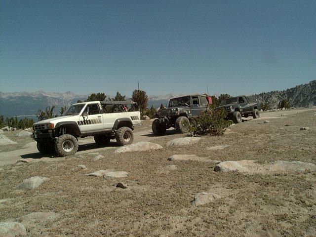
I heard Andrew on the radio around 9 AM and he was in camp a short while later. He had stayed in Shaver Lake. We set up our chairs and enjoyed the September sun, finally breaking out lunch, while we waited to see if anyone else would show up. Finally, we heard Terry's truck and he joined us in a few minutes. It was about 1PM, so we decided to see how far we could get by sunset...
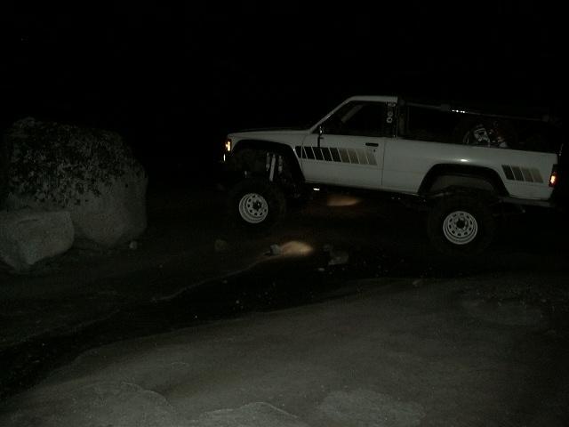
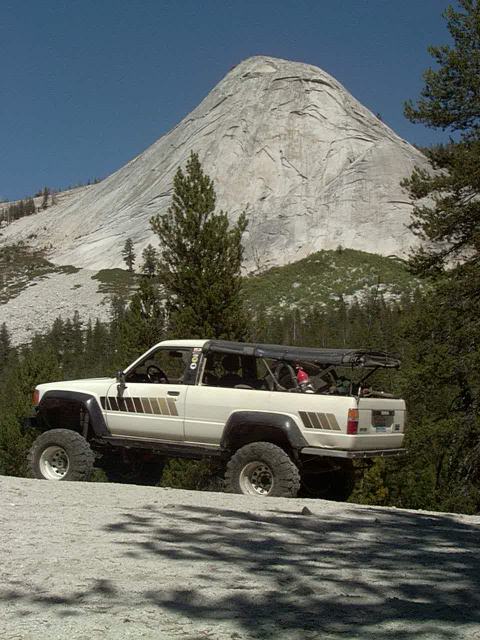
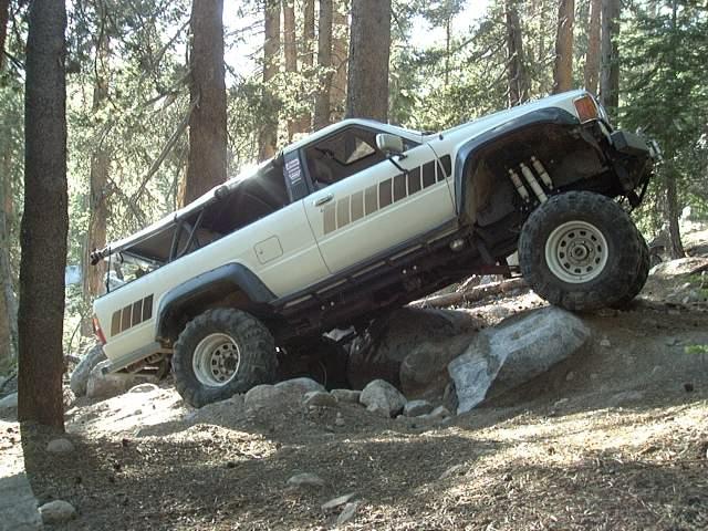
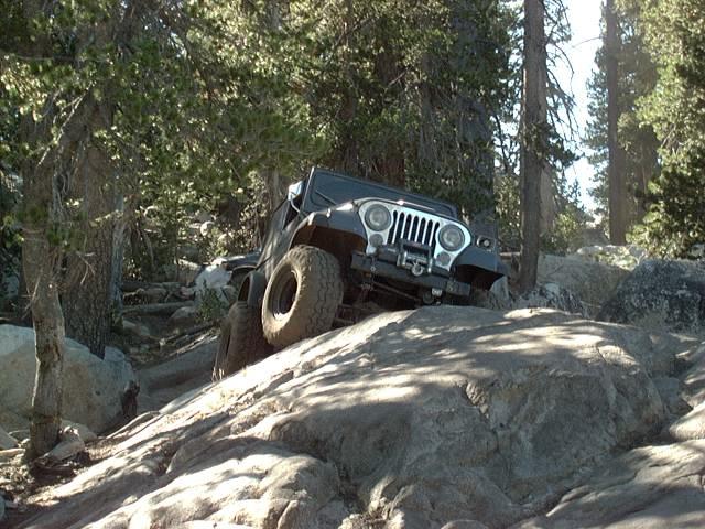
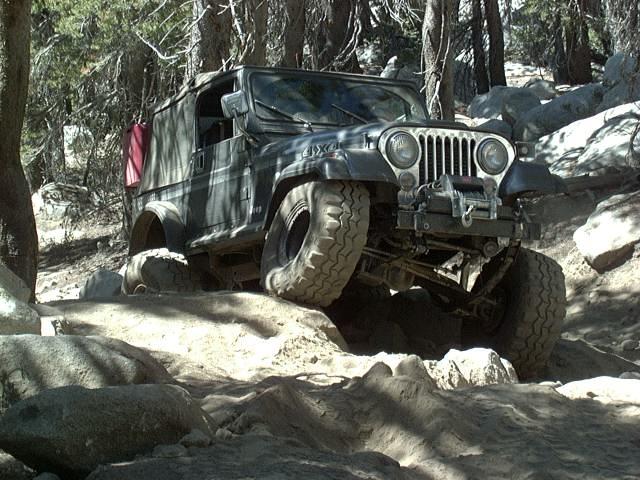
Chicken Rock is right out of camp, a 25° slab of granite that just keeps climbing...
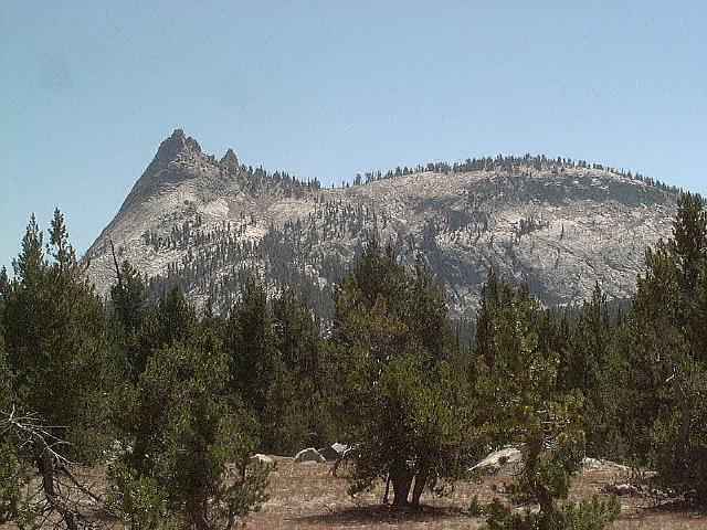
Up on top, we stopped for a few minutes to take in the view,
then dropped down the back side over some difficult terrain until we reached the lake shore again. An abandoned FJ-40 Landcruiser beside the trail was an ominous sign of the difficulty of the trail ahead.
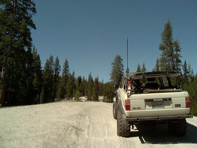
We crossed Thompson Creek and headed upstream, passing granite domes and the glorious Sand Highway. A stretch of smooth fast driving after hours in 4LO.
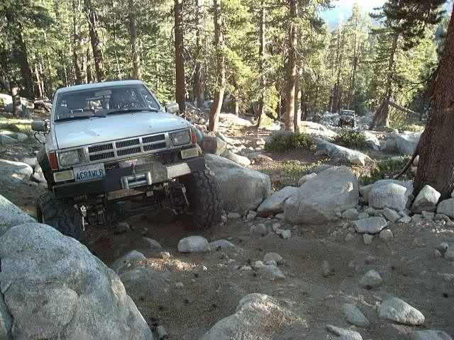
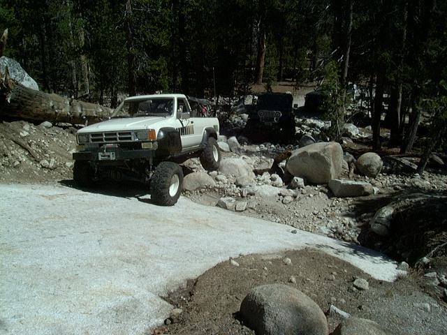
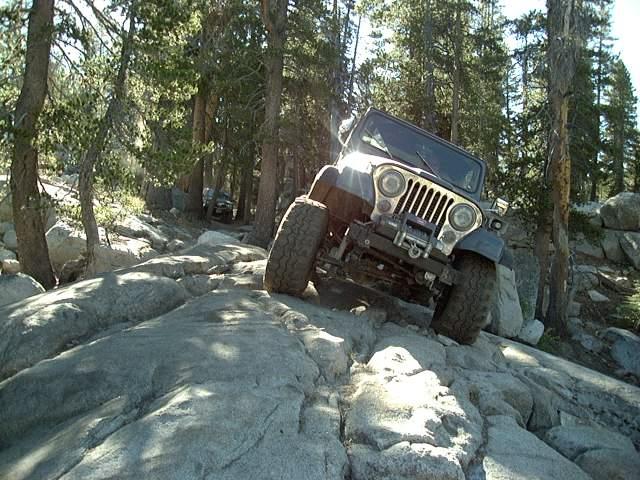
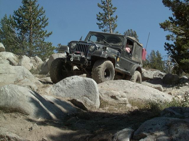
After numerous false starts and just as you are about to give up hope of reaching it, you finally decide you have reached Thompson Hill. You don't realize when you actually reach the base of the hill, but after about 30 minutes of continuous climbing, it becomes obvious that you have arrived. Recent rains had helped to compact the loose soil and kept the dust to a minimum. Thompson Hill is about 1.5 miles long and climbs around 1000' on a loose, rocky hillside starting in the trees and ending in a more open area at 10,000'. There are numerous tricky spots and very few breaks. I took one hard line and had to lock up my ARBs, but other than that, I did the trail with open differentials.
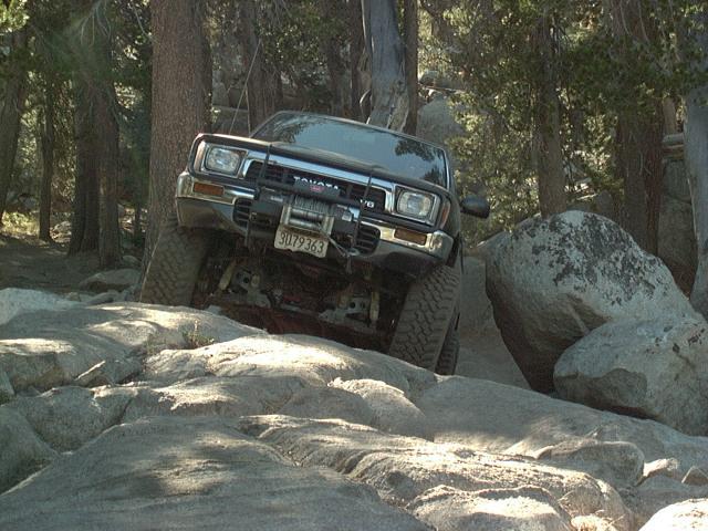
Andrew had his fan shroud come loose and stop his fan from spinning causing the engine to overheat. We removed the shroud, refilled the radiator and aside from one winch pull off a rock that flipped up under his frame, he made it the rest of the way w/o anymore overheating trouble. Terry's longer wheelbase was a big help on the steep climb.
We reached camp just as the sun was setting, very tired from 6 hours of non-stop wheeling, 11 miles down, 22 to go!
Day 2:

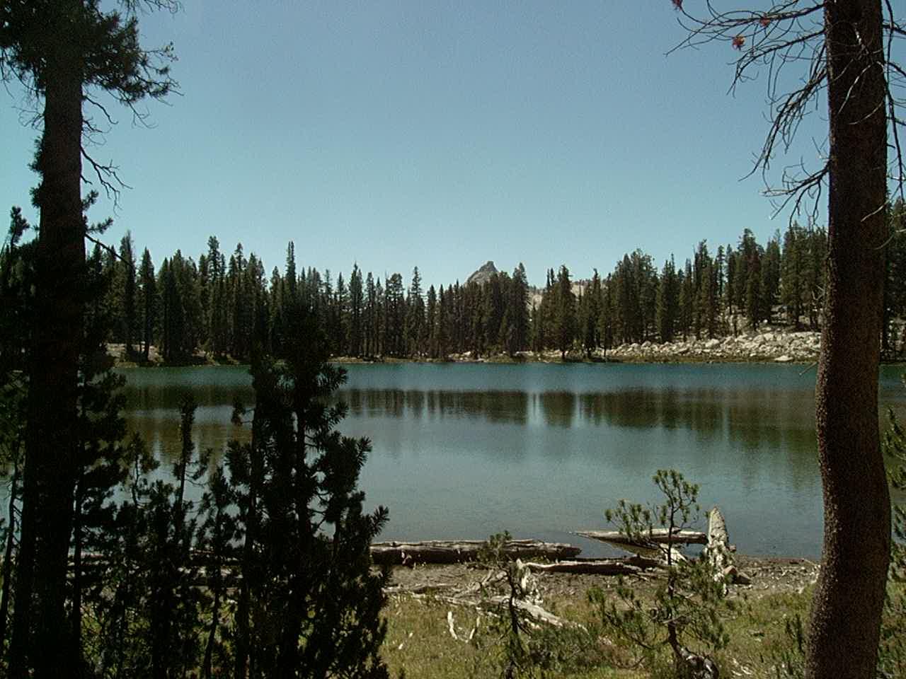
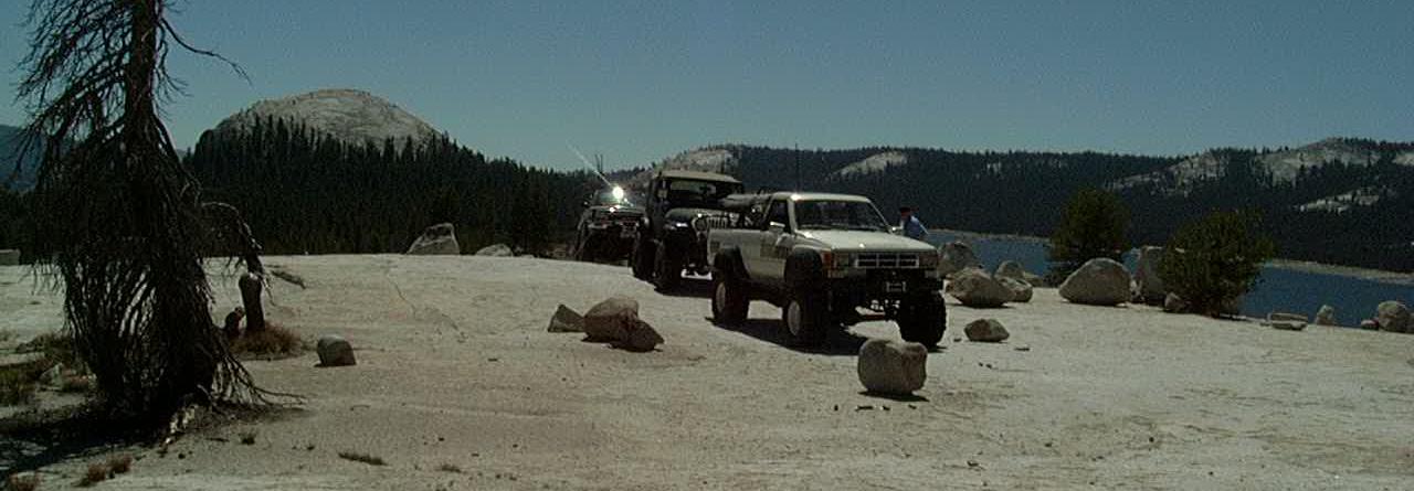
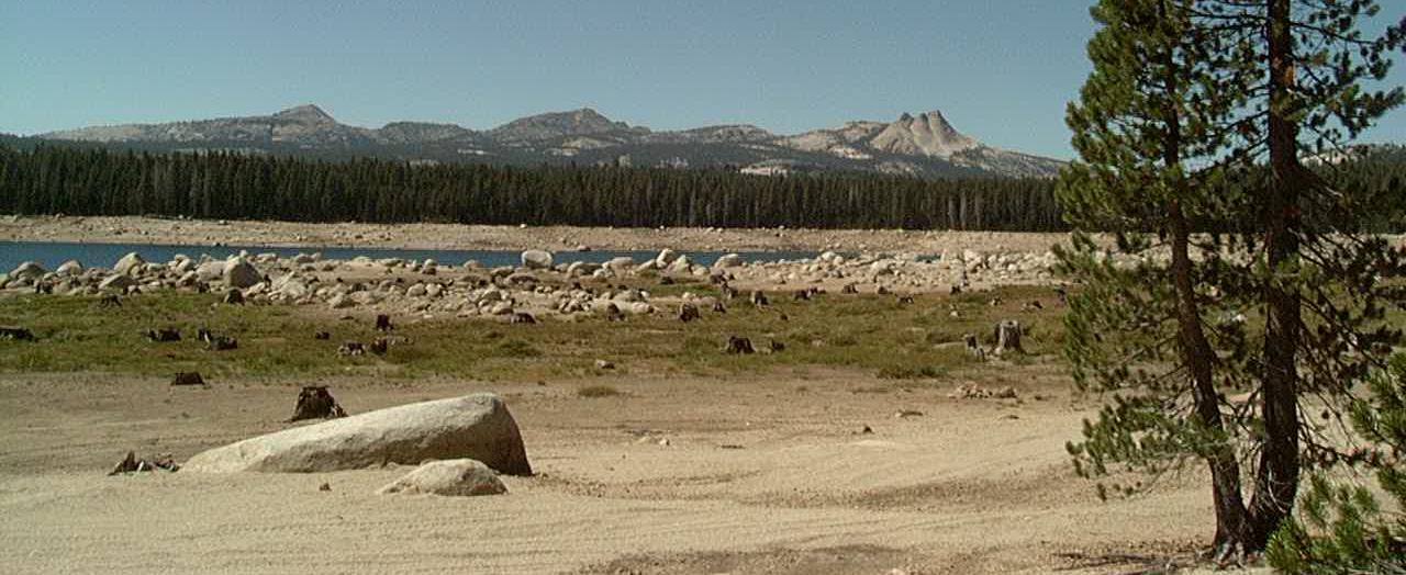
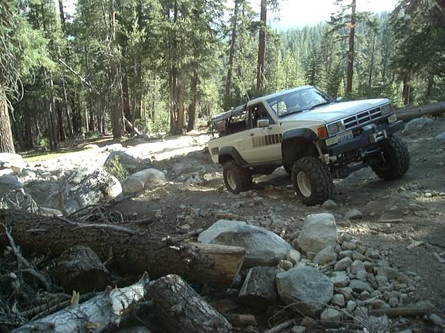
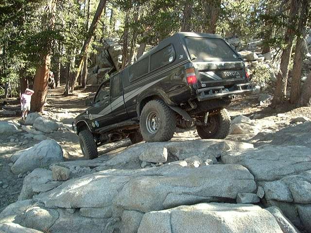
We got going around 10 AM, it was a lot warmer here at 10,000' than the first night at 8000'. We made good time, reaching East Lake a bit before 1PM, where we stopped for lunch. I backed up a boulder (above-left) to get some gas transferred out of my aux. gas tank (and you thought I was just posing for the camera :-). We hiked out to East Lake (above center) then continued on past Dogtooth Peak (above-right) as we headed towards Ershim Lake.
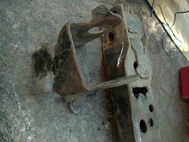

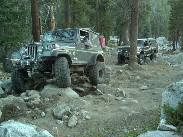
Terry started hearing clunking sounds from the front of his truck. Sure enough, the front IFS brace that holds the front diff in place had broken. He had a spare, which we installed. Unable to get the bolt that holds the diff in place, we used a screwdriver and some baling wire in true McGyver fashion. This held up the rest of the trip.
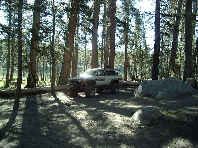
We reached Ershim Lake by mid-afternoon. We were the only 3 rigs in camp. Everyone cleaned up, relaxed and then enjoyed dinner by the campfire. Insects were almost non-existent and it was another nice evening.
Day 3:
We got an earlier start, breaking camp around 9 AM. You hardly have time to get the engines up to operating temperature before confronting Divorce Rock! One can only imagine how this spot got its name :-)
This rock is a huge granite spine, you start off with an off-camber squeeze by a rock on the driver's side, then have to make a blind turn to the right at just the right spot to drop off the rock. Turn too soon and you'll tip to the passenger side, too late and you drive off the end of the rock.
After that, its fairly easy wheeling through the trees, past East Lake and Lakecamp Meadows. There are a few hard climbs on the way up tot he high point on the trail.
You top out above tree line at about 10,200' with spectacular 360° views. Most of the high lakes are visible. You can see down towards the end of the trail, but there are still some surprises in store!

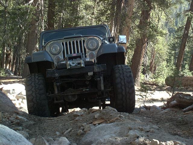
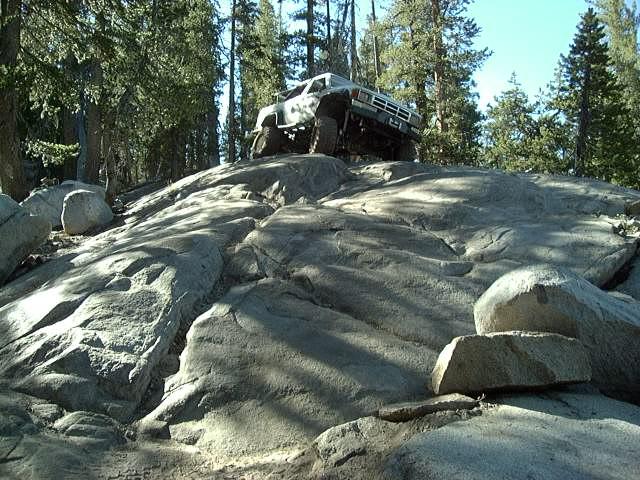
The trail drops pretty much straight dow the side of the hill, over many huge boulders. On the way down, Andrew sheared all 6 bolts off of on front hub, then in an off-camber spot, had his engine stall as the fuel pickup went dry. 5 gallons of gas got him going again. On the way down, Terry snapped the passenger side drive flange stub axle, then in 3WD, broke the outer CV joint on the driver's side. Luckily both breaks needed no immediate attention but he had to finish the trail, including winching over one large pair of boulders that flanked the trail. The hardest part of the trail appeared to have been changed from 2 years ago and it was not as bad with the new route (above-right).
The End:


We made it off the trail, 33 miles in 3 days. Many broken parts and lots of good memories. We aired up and headed back to Shaver Lake then on towards home.
Useful things to know about the Dusy-Ershim Trail:
- This trail is one of the most difficult trails in the USA
- More than half of trucks that run this trail come back with at least minor body damage (dents and scratches) as you must drive very close to large rocks and trees many times
- It is only open a few months a year as snow and mud makes it impassible
- It is long, about 33 miles from end to end, bring extra fuel if you are so inclined
- The driving is slow and the trail is at a fairly high elevation, 10,000 feet in some parts
-
The trail passes through a narrow corridor between two wilderness areas
- There are many lakes and other scenic areas within 1/4 to 1/2 mile hike from the trail if you are so inclined
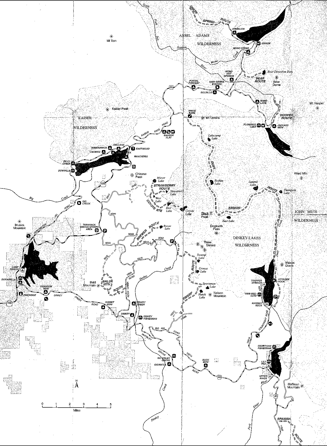
- A larger map of the Sierra National Forest OHV network is available by clicking on the smaller map, below:
![]()
[Last updated: 13.July.2024 ]
Visitor # 9905 since 22.DEC.2004