![]()
![]()
Visitor # 12182 since 14.NOV.2004
![]()
So, I know you aren't supposed to travel solo in the desert, but this wasn't the first (or last) time that I've done it (one vehicle and one driver in th emiddle of the summer to boot!). After a hastily planned trip finally came together, I took off late Sunday (6/28/98) afternoon, crossing Ebbetts Pass on CA-4 about sunset. I gassed up in Bishop, CA around midnight and found a place to pull off the road after turning onto Saline Valley Road from CA-168.
 After
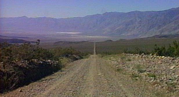
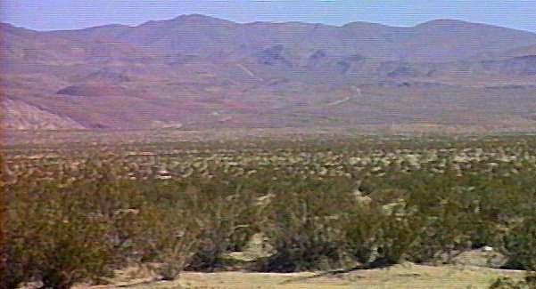
a short night, I was up at the crack of dawn. Explored some side roads
in Marble Canyon then finally saw into the depths of Saline Valley.
After
a short night, I was up at the crack of dawn. Explored some side roads
in Marble Canyon then finally saw into the depths of Saline Valley.
 After
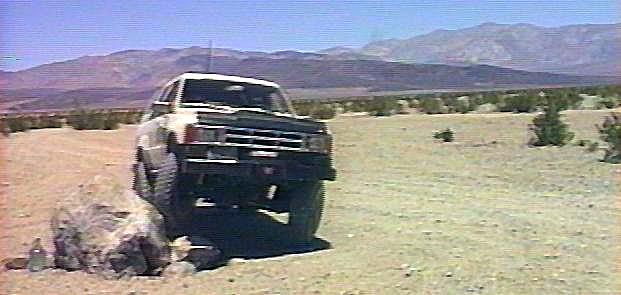
reaching the valley floor, you'll see a painted rock (Bat Rock*) which marks the turnoff to the warm
springs. I had to try out my new Marlin dual transfer case here, so I
dropped it into low range and let the passenger front tire crawl up the
rock.
After
reaching the valley floor, you'll see a painted rock (Bat Rock*) which marks the turnoff to the warm
springs. I had to try out my new Marlin dual transfer case here, so I
dropped it into low range and let the passenger front tire crawl up the
rock.
 °
° A
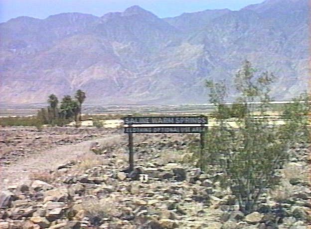
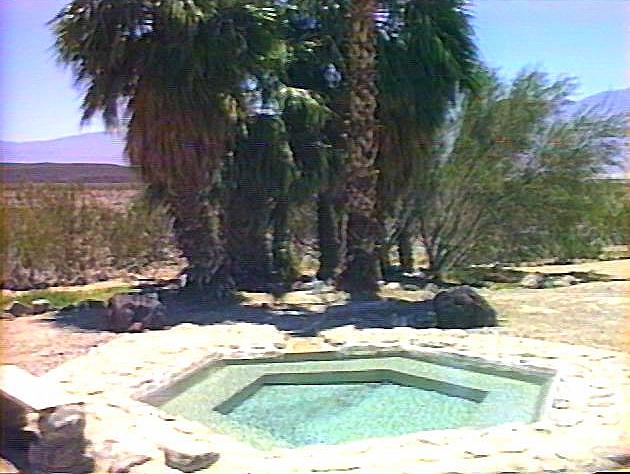
few miles from the rock, you'll reach first Lower Warm Spring with its
year round residents, including Lizard Lee and Chili Bob, famous after
the 1995 National Geographic article. A mile or so above the lower
spring is Upper Warm Spring (pictured here) and the beginning of the
4WD road to Steel Pass. There is an undeveloped spring above here as
well as the "marble tub", neither of which I've seen. Here's
an excellent LA Times article on the Hot Springs.
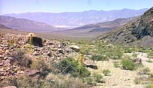
A
few miles from the rock, you'll reach first Lower Warm Spring with its
year round residents, including Lizard Lee and Chili Bob, famous after
the 1995 National Geographic article. A mile or so above the lower
spring is Upper Warm Spring (pictured here) and the beginning of the
4WD road to Steel Pass. There is an undeveloped spring above here as
well as the "marble tub", neither of which I've seen. Here's
an excellent LA Times article on the Hot Springs.
 I
was here to wheel, so this is the 4WD road towards Steel Pass. There is
one rocky ledge you climb shortly after leaving Upper Warm Springs,
then a few tught turns in the creek bottom. At the top of the pass is a
washed out, off-camber stretch that will get your blood pumping,
especially going down towards Saline Valley. I didn't have time to
proceed into Eureka Valley and its magnificent sand dunes this time.
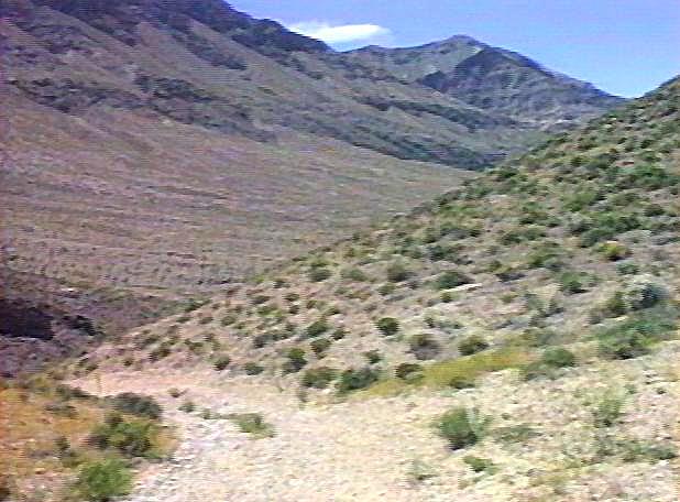
I
was here to wheel, so this is the 4WD road towards Steel Pass. There is
one rocky ledge you climb shortly after leaving Upper Warm Springs,
then a few tught turns in the creek bottom. At the top of the pass is a
washed out, off-camber stretch that will get your blood pumping,
especially going down towards Saline Valley. I didn't have time to
proceed into Eureka Valley and its magnificent sand dunes this time.
 At
the south end of the valley, you can drive out to the shore of the salt
pans. Here you'll see a string of old wooden towers that one supported
the salt tram that went up and over McElvoy Canyon (in the distance)
over the crest of the Inyo Mountains and then down to Owens Lake near
the town of Keeler. The tram was built around the turn of the century
but was never economically viable. The plan was to mine salt in Saline
Valley, transport it over the Inyos to be processed there, ship it
across Owens Lake and ultimately to market in Los Angeles. The salt
here is so pure that no purification is required. A problem arose soon
after the tram was finished, it was designed to carry dry salt, so its
capacity was drastically reduced because it had to carry the wet salt
over the mountains. Evidently miners rode the tram over the mountains
to and from Keeler, that must have been exiting!
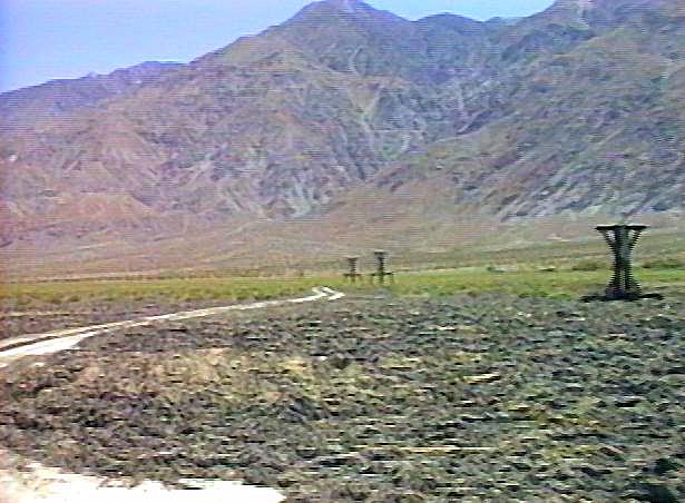
At
the south end of the valley, you can drive out to the shore of the salt
pans. Here you'll see a string of old wooden towers that one supported
the salt tram that went up and over McElvoy Canyon (in the distance)
over the crest of the Inyo Mountains and then down to Owens Lake near
the town of Keeler. The tram was built around the turn of the century
but was never economically viable. The plan was to mine salt in Saline
Valley, transport it over the Inyos to be processed there, ship it
across Owens Lake and ultimately to market in Los Angeles. The salt
here is so pure that no purification is required. A problem arose soon
after the tram was finished, it was designed to carry dry salt, so its
capacity was drastically reduced because it had to carry the wet salt
over the mountains. Evidently miners rode the tram over the mountains
to and from Keeler, that must have been exiting!
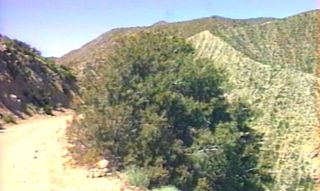 After
climbing out of Grapeview Canyon (so named for the lush grape vines
lining the canyon walls) you'll reach the turn off for Hunter Mountain.
I once again did not have time to explore this road, which will take
you to Death Valley, via the road to the Racetrack and Ubehebe Crater.
After
climbing out of Grapeview Canyon (so named for the lush grape vines
lining the canyon walls) you'll reach the turn off for Hunter Mountain.
I once again did not have time to explore this road, which will take
you to Death Valley, via the road to the Racetrack and Ubehebe Crater.
If you visit Saline Valley now, you'll find that Bat Rock is no longer with us :-(. Apparently the National Park Service, in their infinite wisdom, decided that the rock did not belong there. So they dug a big hole and buried it. I guess they felt it was a magnet for grafitti and unsightly water jugs. Same fate for the tea kettle at Tea Kettle Junction, tea kettles were removed.
The background for this page is an image of Zabriske Point. I post-processed the image with Silicon Graphics Image Vision toolkit by running a Sobel Edge Detection filter on it, then rotated and cropped the image slightly to get the edges to tile properly.
![]()
![]()